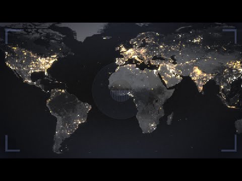
Occasionally we have posted a nighttime satellite image that shows where the lights are on in one country or another. But now we have a composite image that shows the entire world on a Mercator projection and how it is lit up at night. Yeah, of course it would have to a composite, because it’s never nighttime for the whole world. The huge number of individual images used to make this map also allows us to zoom in and see what the light -or lack of it- tells us about different regions. For example, there are no lines normally visible from space to tell us where national borders are, but the policies of different countries can make it seem that way when one nation has plenty of light, while its neighbor has none. Comparing images taken over time can show population growth, economic growth, or the effects of war. -via Digg
Listen beautiful relax classics on our Youtube channel.
Source: neatorama